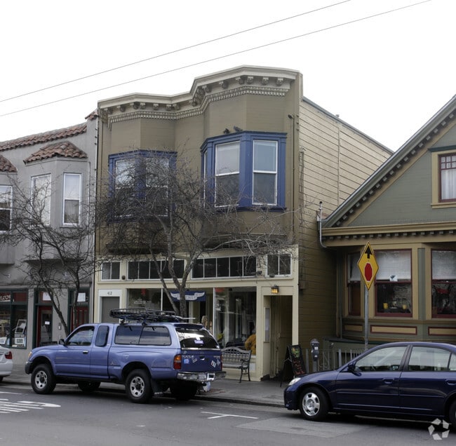
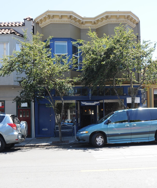
Property Record
408 Cortland Ave, San Francisco, CA 94110
Current Lease Availabilities
NEARBY LISTINGS FOR SALE OR LEASE
Property Detail
408 Cortland Ave
San Francisco
Fairs Subdivision Of Holly Park Tract
San Francisco-Redwood City-South San Francisco, CA
BLK 9 LOT 9
5678-025
San Francisco
Retailwithmorethanonenonretailuse
California
2024
25
2025
0.06 AC
025401
Southern City
2,800 SF
DEMOGRAPHICS near 408 Cortland Ave
1 Mile
3 Mile
5 Mile
2024 Total Population
61,479
421,300
839,287
2029 Population
56,580
388,370
777,232
Pop Growth 2024-2029
(7.97%)
(7.82%)
(7.39%)
Average Age
42
42
42
2024 Total Households
22,715
163,664
349,628
HH Growth 2024-2029
(8.34%)
(8.08%)
(7.74%)
Median Household Inc
$147,836
$133,699
$124,479
Avg Household Size
2.60
2.40
2.30
2024 Avg HH Vehicles
1.00
1.00
1.00
Median Home Value
$1,104,307
$1,086,666
$1,092,095
Median Year Built
1947
1950
1949
Nearby Places
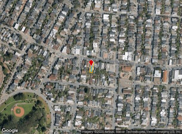
Map Layers
Map Styles
 Street
 Aerial
- Restaurants
- Banks
- Shops
- Fitness
- Groceries
PUBLIC TRANSPORTATION
TRANSIT/SUBWAY
San Jose Ave & Randall St (J Church - San Francisco Municipal Railway (MUNI Metro))
DRIVE
WALK
Distance
San Jose Ave & Randall St (J Church - San Francisco Municipal Railway (MUNI Metro))
5 min
9 min
0.5 mi
San Jose and Randall (J Church - San Francisco Municipal Railway (MUNI Metro))
DRIVE
WALK
Distance
San Jose and Randall (J Church - San Francisco Municipal Railway (MUNI Metro))
5 min
9 min
0.5 mi
30th Street and Dolores (J Church - San Francisco Municipal Railway (MUNI Metro))
DRIVE
WALK
Distance
30th Street and Dolores (J Church - San Francisco Municipal Railway (MUNI Metro))
4 min
9 min
0.5 mi
J Line Outbound (J Church - San Francisco Municipal Railway (MUNI Metro))
DRIVE
WALK
Distance
J Line Outbound (J Church - San Francisco Municipal Railway (MUNI Metro))
5 min
13 min
0.7 mi
Church and 30th Street (J Church - San Francisco Municipal Railway (MUNI Metro))
DRIVE
WALK
Distance
Church and 30th Street (J Church - San Francisco Municipal Railway (MUNI Metro))
5 min
13 min
0.7 mi
COMMUTER RAIL
22nd Street (Caltrain - Caltrain (Caltrain))
DRIVE
WALK
Distance
22nd Street (Caltrain - Caltrain (Caltrain))
10 min
2.5 mi
Bayshore (Caltrain - Caltrain (Caltrain))
DRIVE
WALK
Distance
Bayshore (Caltrain - Caltrain (Caltrain))
8 min
3.7 mi
AIRPORT
San Francisco International
DRIVE
WALK
Distance
San Francisco International
16 min
11.1 mi
Metro Oakland International
DRIVE
WALK
Distance
Metro Oakland International
31 min
22.3 mi
Freight Ports
Port of San Francisco
DRIVE
WALK
Distance
Port of San Francisco
1 min
4.2 mi
Nearby Properties
Address
Land Use
TOTAL SIZE
Lot Size
Zoning
Address
Land Use
TOTAL SIZE
Lot Size
Zoning
750,370 SF
3.25 AC
MBR3
Address
Land Use
TOTAL SIZE
Lot Size
Zoning
248,303 SF
4.35 AC
Address
Land Use
TOTAL SIZE
Lot Size
Zoning
717,234 SF
3.47 AC
UMU
Address
Land Use
TOTAL SIZE
Lot Size
Zoning
10.92 AC
Address
Land Use
TOTAL SIZE
Lot Size
Zoning
885,581 SF
5.20 AC
M2
Address
Land Use
TOTAL SIZE
Lot Size
Zoning
1.52 AC
C3G
Address
Land Use
TOTAL SIZE
Lot Size
Zoning
2.74 AC
Address
Land Use
TOTAL SIZE
Lot Size
Zoning
313,306 SF
1.23 AC
WMUG
Address
Land Use
TOTAL SIZE
Lot Size
Zoning
314,826 SF
1.85 AC
MB-RA
Address
Land Use
TOTAL SIZE
Lot Size
Zoning
10.92 AC
Address
Land Use
TOTAL SIZE
Lot Size
Zoning
393,918 SF
3.36 AC
WMUG
Address
Land Use
TOTAL SIZE
Lot Size
Zoning
24.37 AC
Address
Land Use
TOTAL SIZE
Lot Size
Zoning
241,659 SF
3.76 AC
Address
Land Use
TOTAL SIZE
Lot Size
Zoning
230,853 SF
3.76 AC
Address
Land Use
TOTAL SIZE
Lot Size
Zoning
302,084 SF
0.88 AC
MBO
Address
Land Use
TOTAL SIZE
Lot Size
Zoning
674,317 SF
3.36 AC
UMU
Address
Land Use
TOTAL SIZE
Lot Size
Zoning
319,119 SF
0.76 AC
Address
Land Use
TOTAL SIZE
Lot Size
Zoning
222,000 SF
1 AC
MB-RA
Address
Land Use
TOTAL SIZE
Lot Size
Zoning
10.92 AC
Address
Land Use
TOTAL SIZE
Lot Size
Zoning
2.93 AC
Address
Land Use
TOTAL SIZE
Lot Size
Zoning
342,727 SF
1.36 AC
C3G
Address
Land Use
TOTAL SIZE
Lot Size
Zoning
291,522 SF
6.66 AC
CM
Address
Land Use
TOTAL SIZE
Lot Size
Zoning
250,884 SF
1.66 AC
MB-RA
Address
Land Use
TOTAL SIZE
Lot Size
Zoning
375,030 SF
0.96 AC
Address
Land Use
TOTAL SIZE
Lot Size
Zoning
248,974 SF
0.88 AC
MBO
Address
Land Use
TOTAL SIZE
Lot Size
Zoning
345,000 SF
1.74 AC
WMUG
Address
Land Use
TOTAL SIZE
Lot Size
Zoning
2.22 AC
M1
Address
Land Use
TOTAL SIZE
Lot Size
Zoning
332,221 SF
1.17 AC
Address
Land Use
TOTAL SIZE
Lot Size
Zoning
2.06 AC
Address
Land Use
TOTAL SIZE
Lot Size
Zoning
333,244 SF
2.67 AC
UMU
The World's #1 Commercial Real Estate Marketplace
Connect with us
© 2025 CoStar Group
The information above has been obtained from sources believed reliable. While we do not doubt its accuracy we have not verified it and make no guarantee, warranty or representation about it. It is your responsibility to independently confirm its accuracy and completeness. Any projections, opinions, assumptions, or estimates used are for example only and do not represent the current or future performance of the property. The value of this transaction to you depends on tax and other factors which should be evaluated by your tax, financial, and legal advisors. You and your advisors should conduct a careful, independent investigation of the property to determine to your satisfaction the suitability of the property for your needs.